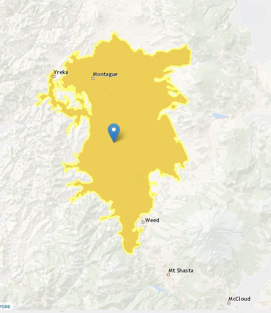
Shasta Valley
Statistics
- Basin Name
- Shasta Valley
- Basin Number
- 1-004
- SGMA Basin Priority
- Medium
- Critically Overdrafted
- No
- Hydrologic Region Name
- North Coast
- Counties
- Siskiyou
- Adjacent Basins
-
No items found
At-A-Glance
Located in California’s North Coast hydrologic region, the Shasta Valley is 218,215.03 acres in size. This Medium priority basin is home to an estimated 13,070. people (2010 value). Groundwater accounts for approximately 23 percent of the basin’s water supply.

Basin Notes
1960: Geology and Ground- Water Features of Shasta Valley, Siskiyou County California by Seymour Mack, U.S. Geological Survey
2003: Bulletin 118 basin description
2010: Longitudinal Baseline Assessment of Salmonid Habitat Characteristics of the Shasta River, March through September, 2008, U.C. Davis, Pub. 2010
2018: Noted on Draft SGMA Prioritization: “Complex GW management issues internally and externally involving the basin hydrology, contributing volcanic aquifers, surface water with fisheries dependence.” 2019: Basin boundary modification approved to “revise and expand the external Shasta Valley basin to include the volcanic regional aquifer system.” Statewide SGMA
2019: Basin Prioritization Results- Medium. Comment: “During the irrigation season (April 1 to October 1), temporally-variable surface water diversions and presumable seasonal groundwater pumping reduced streamflows in Big Springs Creek (mean = 52 ft3/s; minimum = 40 ft3/s). Streamflow rebounded rapidly to unimpaired baseflow conditions following the cessation of the irrigation season (September 30). During the summer and fall, Big Springs Creek, along with several other discrete and diffuse springs, provide During the the irrigation season (April 1 to October 1), temporally-variable surface water diversions and presumable seasonal groundwater pumping reduced streamflows in Big Springs Creek (mean = 52 ft3/s; minimum = 40 ft3/s). Streamflow rebounded rapidly to unimpaired baseflow conditions following the cessation of the irrigation season (September 30). During the summer and fall, Big Springs Creek, along with several other discrete and diffuse springs, provide the majority of streamflow to the Shasta River below. From April 1 to April 12, 2008 discharge in the Shasta River at Montague was reduced from 143 ft3/s to 43 ft3/s (~70 percent), signifying the large and rapid reduction of groundwater-fed baseflows throughout the basin in response to irrigation diversions and groundwater pumping. Source: Longitudinal Baseline Assessment of Salmonid Habitat Characteristics of the Shasta River, March through September, 2008, U.C. Davis
2019: Basin boundary modification approved. Per DWR: It “would revise and expand the external Shasta Valley basin to include the volcanic regional aquifer system. The requesting agency provides sufficient information with respect to land and water use, scientific studies, and the best available geologic mapping. Five letters of support and no letters of opposition are associated with the request. The initial submittal by Siskiyou County request was denied due to lack of sufficient scientific information to support including expanded area of volcanic deposits and lacked demonstration that the areas met the regulatory definitions of ‘aquifer’ and ‘basin’. A total of 13 public comments were received on the initial DWR draft decision that supported the agency’s original request. Siskiyou County provided a technical study that included a statistical analysis of well log information and subsurface conditions in the areas desired to be added to the existing basin. The analysis revealed that a significant number (77%) of wells were constructed within sediment-based aquifers, although intermixed with volcanic rock. The additional supporting information satisfactorily meets the regulatory requirements.” Phase 2 draft priority: medium.
2022: January 28 Groundwater Sustainability Plan submitted to DWR
2023: Groundwater Sustainability Plan approved by DWR
