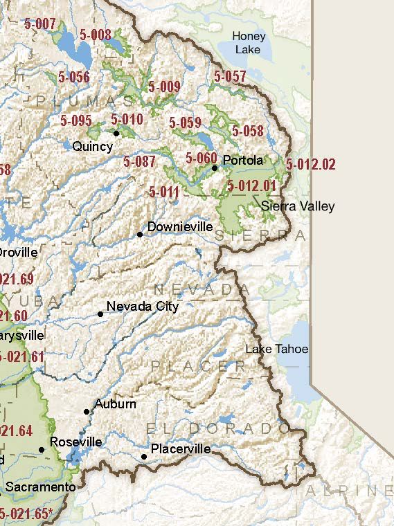
Sierra Valley
Statistics
- Basin Name
- Sierra Valley
- Basin Number
- 5-012.01
- SGMA Basin Priority
- Medium
- Critically Overdrafted
- No
- Hydrologic Region Name
- Sacramento River
- Counties
- Plumas, Sierra
- Adjacent Basins
-
No items found
At-A-Glance
Located in California’s Sacramento River hydrologic region, the Sierra Valley is 117,292.42 acres in size. This Medium priority basin is home to an estimated 2,192.00 people (2010 value). It has approximately 10 are water supply wells. Groundwater accounts for approximately 40.00 percent of the basin’s water supply.

Basin Notes
2003: Bulletin 118 basin description
2014: CASGEM basin prioritization: medium. Comment – Declining GW Levels and artesian well production along the east and northeast side of the valley. Poor quality water in west‐central side of valley (boron, fluoride, arsenic, & sodium). Inventory of Sierra Valley Wells and Groundwater Quality Conditions, Plumas County Planning Department, Sierra Valley Groundwater Management District
- Headwaters for Middle Fork Feather River (National Wild and Scenic)/State Water Project – Lake Oroville 2) Basin has had significant amount of State funding and investments toward groundwater study – multiple grant funded groundwater monitoring and study programs. 3) Largest fresh water marsh in the Sierra Mountains
Groundwater and subsidence comments-
- 1) CASGEM/WDL/GWIDS: Longterm hydrographs show groundwater level decline. Source: DWR 2) Majority of long-term hydrographs are relatively stable, a few with declining groundater levels. Source: http://sierravalleygmd.org/TechnicalReport.pdf page 79+
- 1) Reports subsidence in various locations in the basins ranging from 1.5 ft to 2.2 feet Source: DWR, Sierra Valley Groundwater Study, 1983, pg 59 2) Reports approximately 6 inches of subsidence between 5/2015 and 6/2016 Sources: DWR/JPL, Subsidence in California, March 2015 ? September 2016, 2017, pgs 20-21 2016
- Surface water adverse impacts: Several monitoring wells adjacent to wetlands and streams are showing significant declines that could be impacting the largest fresh water marsh in the Sierra Mountains and the Middle Fork Feather River that is designated as a National Wild and Scenic River.
U.S. Geological Survey Sacramento River Headwaters resource page
2019: Basin boundary modification approved. Per DWR: “It removes a small mapped alluvial area from the delineation of the Sierra Valley basin. Geologic maps, well completion reports, and technical studies submitted by the requesting agency indicate that the area is not an alluvial basin, nor is it hydrologically connected to the Sierra Valley Basin.” Phase 2 Draft priority: medium.
2022: January 28 – Groundwater Sustainability Plan (GSP) submitted to Department of Water Resources (DWR)
2023: July 27 – DWR approved GSP
