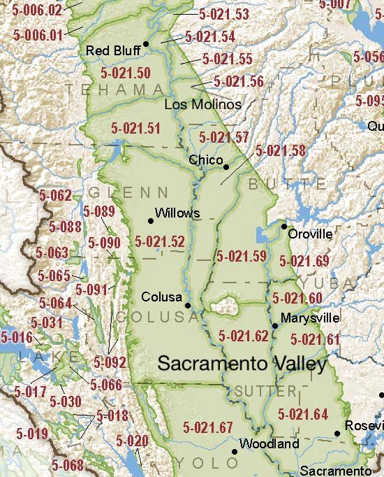
Sacramento Valley – Los Molinos
Statistics
- Basin Name
- Sacramento Valley – Los Molinos
- Basin Number
- 5-021.56
- SGMA Basin Priority
- Medium
- Critically Overdrafted
- No
- Hydrologic Region Name
- Sacramento River
- Counties
- Butte, Tehama
At-A-Glance
Located in California’s Sacramento River hydrologic region, the Sacramento Valley – Los Molinos subbasin is 99,422.40 acres in size. This Medium priority basin is home to an estimated 4,425 people (2010 value). It has approximately 1,241 wells, of which approximately 18 are water supply wells. Groundwater accounts for approximately 54 percent of the basin’s water supply.

Basin Notes
2003: Bulletin 118 basin description
2014: Basin prioritization – medium. Comment: Boron issues along east-side of basin. GW basin provides underflow to Mill Creek which supports endangered spring-run salmon. High SW-GW interaction for much of the western basin. GW Use based on 2003 Tehama Co GW Inventory data
2018: draft priority – Very Low. Downgrade left un-explained with a reference to a blank entry field (8c) on DWR prioritization dashboard Basin boundary modification request to consolidate basins of Tehama County pending with DWR.
2019: Basin boundary modification approved. Per DWR: It “consolidates the Dye Creek subbasin, Los Molinos subbasin, and Tehama County portion of the Vina subbasin into a single subbasin named the Los Molinos subbasin. The modification correlates with a separate request submitted by Butte County Department of Water and Resource Conservation to expand the Butte County portion of the Vina subbasin.” Phase 2 draft basin priority: Medium.
2022: January 31st – Groundwater Sustainability Plan submitted to DWR.
2023: October 26 – GSP deemed incomplete by DWR. GSA given 180 days to address deficiencies.
December 11 – Addressing Groundwater Overdraft in the Sacramento Valley, Public Policy Institute of California
