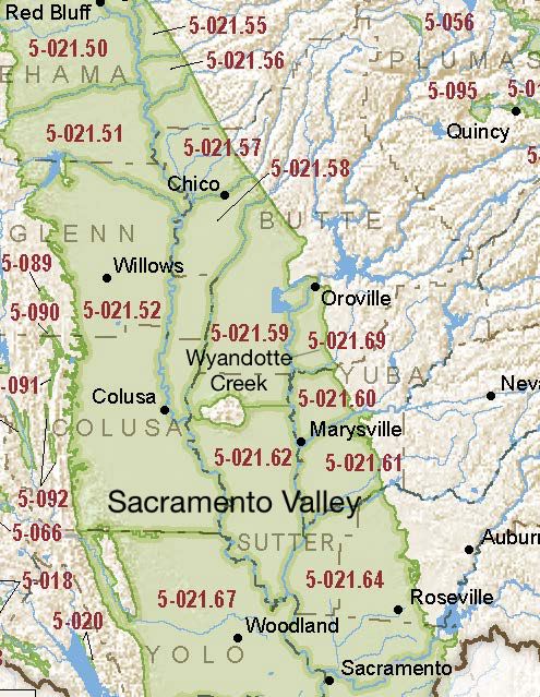
Sacramento Valley – Wyandotte Creek
Statistics
- Basin Name
- Sacramento Valley – Wyandotte Creek
- Basin Number
- 5-021.69
- SGMA Basin Priority
- Medium
- Critically Overdrafted
- No
- Hydrologic Region Name
- Sacramento River
- Counties
- Butte
- Adjacent Basins
At-A-Glance
Located in California’s Sacramento River hydrologic region, the Sacramento Valley – Wyandotte Creek subbasin is 59,382.18 acres in size. This Medium priority basin is home to an estimated 32,252 people (2010 value). It has approximately 982 wells, of which approximately 23 are water supply wells. Groundwater accounts for approximately 84 percent of the basin’s water supply.

Basin Notes
2016: Formerly part of the North Yuba subbasin, Wyandotte Creek was formed when DWR split the basin along the Butte-Yuba county line (October 2016).
2018: Draft basin prioritization – medium. Comment: 1) CASGEM/WDL/GWIDS: No data or data insufficent to determine GWL status. Source: DWR 2) Hydrographs shown in Yuba County Water Agency North Yuba Subbasin Boundary Modification Proposal are stable. Butte County basin boundary modification request by East Butte subbasin 5-021.69 to alter border pending Butte County basin boundary/consolidation request for Wyandotte Creek and the Corning 5-021.51, Colusa 5-021.52, Vina 5-021.57, West Butte 5-021.58, East Butte 5-021.59, Sutter 5-021.62 subbasins pending
2019: Basin boundary modifications. Phase 2 draft basin priority: medium
2022: January 28 – Groundwater Sustainability Plan (GSP) submitted to Department of Water Resources (DWR)
2023: GSP approved by DWR
