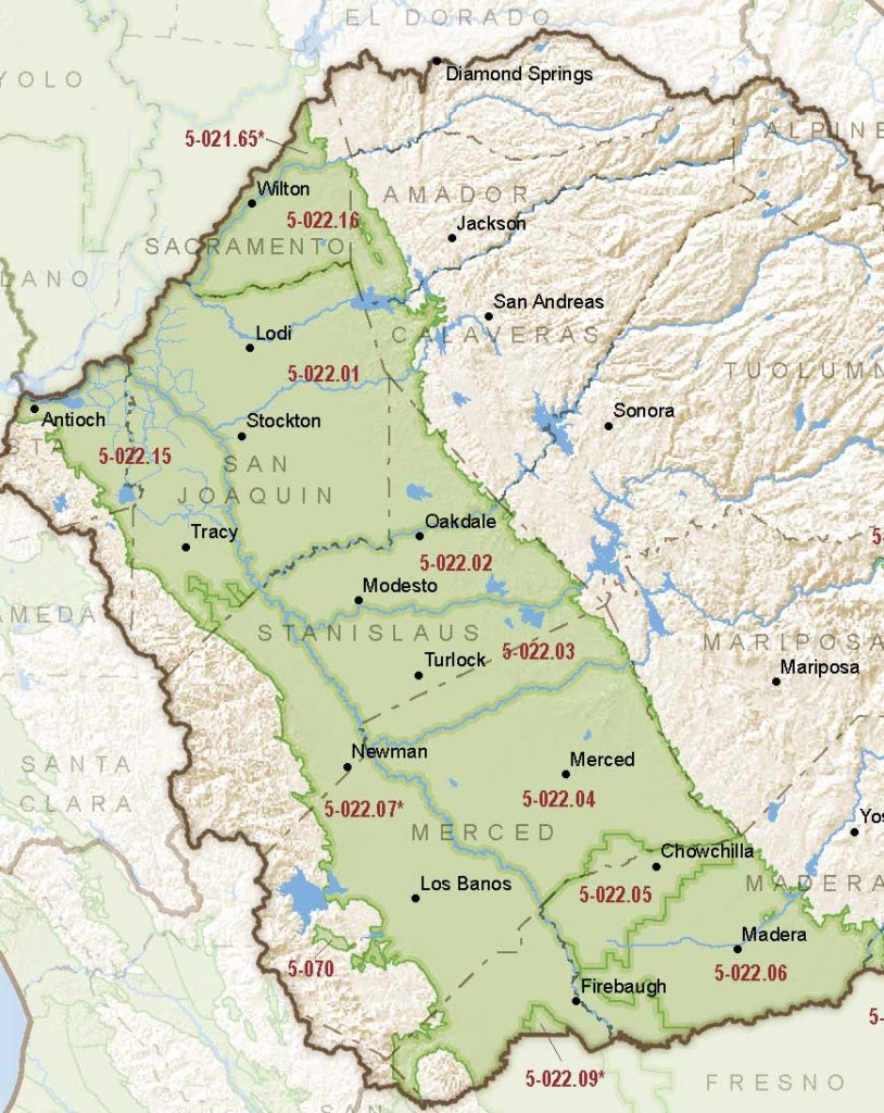
San Joaquin Valley – Chowchilla
Statistics
- Basin Name
- San Joaquin Valley – Chowchilla
- Basin Number
- 5-022.05
- SGMA Basin Priority
- High
- Critically Overdrafted
- Yes
- Hydrologic Region Name
- San Joaquin River
- Counties
- Madera
At-A-Glance
Located in California’s San Joaquin River hydrologic region, the San Joaquin Valley – Chowchilla subbasin is 145,574.30 acres in size. This High priority basin is home to an estimated 15,100 people (2010 value). It has approximately 1489 wells, of which approximately 16 are water supply wells. Groundwater accounts for approximately 95.58 percent of the basin’s water supply.

Basin Notes
2003: Bulletin 118 basin description
2014: CASGEM basin prioritization – high
2016: Basin boundary modification with the Madera subbasin
2018: Draft basin priority – high. Comments on groundwater levels and subsidence:
- CRITICAL OVERDRAFT 2016. Source: DWR 1) CASGEM/WDL/GWIDS: Longterm hydrographs show groundwater level decline. Source: DWR
- 2) Groundwater levels in the Chowchilla Groundwater Basin have declined an average of 40 ft from 1970 through 2000. Limited information is available on groundwater trends for the Chowchilla Groundwater Basin after the year 2000.
- Sources : 1) Current land subsidence in the San Joaquin Valley, USGS; 2) 2014 – Land Subsidence from Groundwater Use in California, California Water Foundation / James W. Borchers / Michael Carpenter, Luhdorff & Salmanini, April 2014; 3) Progress Report: Subsidence in the Central Valley, California, Jet Propulsion Laboratory, California Institute of Technology, NASA 2015-16; 4) San Joaquin River Restoration Program / US Bureau of Reclamation monitoring
Groundwater Quality in the Shallow Aquifers of the Madera– Chowchilla and Kings Subbasins, San Joaquin Valley, California, U.S. Geological Survey, January 2018
2019: Basin boundary modification. Per DWR: It “revises the easterly portion of the Chowchilla Merced subbasins boundary to follow the Madera- Merced County line.” Phase 2 draft priority remains high.
2020: January – Chowchilla Subbasin Sustainabile Groundwater Management Act Groundwater Sustainability Plan published
2021: November – DWR notified Chowchilla plan managers that “Department staff find that the Chowchilla Subbasin GSP’s explanation of the chronic lowering of groundwater levels sustainable management criteria, particularly for undesirable results and minimum thresholds, does not include sufficient detail and analysis required by the GSP Regulations. “
2022: July 27 – Chowchilla plan managers submit a revised GSP
2023: March 2 – DWR deems the revised GSP inadequate
