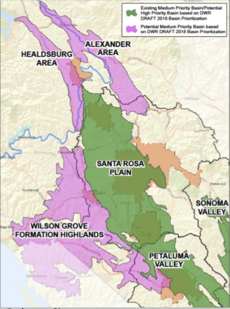
Wilson Grove Formation Highlands
Statistics
- Basin Name
- Wilson Grove Formation Highlands
- Basin Number
- 1-059
- SGMA Basin Priority
- Very Low
- Critically Overdrafted
- No
- Hydrologic Region Name
- North Coast
- Counties
- Marin, Sonoma
- Adjacent Basins
At-A-Glance
Located in California’s North Coast hydrologic region, the Wilson Grove Formation Highlands is 63,836.66 acres in size. This Very Low priority basin is home to an estimated 24,797 people (2010 value). It has approximately 5767 wells, of which approximately 70 are water supply wells. Groundwater accounts for approximately 74 percent of the basin’s water supply.

Basin Notes
2003: Bulletin 118 basin description
2018: Draft 2018 Basin Prioritization Basin Results ‐ Part 15/18/2018 Sonoma Valley Groundwater Sustainability Agency response to reprioritization Basin boundary modification requests 1, 2 pending from Petaluma Valley 2-001 and Sand Point Area 2-027
2019: Basin boundary modification approved revising a portion of the shared boundary between the Petaluma Valley basin and the Wilson Grove Formation Highlands basin so the majority of the City of Petaluma is within the Petaluma Valley basin. 2019 Basin Prioritization Phase 2 Draft: very low GAMA report: “In the North San Francisco Bay study unit (Wilson Grove Formation Highlands, Alexander Valley, Santa Rosa Valley, Petaluma Valley, Lower Russian River Valley, Kenwood Valley, Volcanic Highlands, and Napa-Sonoma Valley GW basins), TDS was present at high concentrations (greater than the upper limit) in about 1% of the primary aquifers. About 7% of the primary aquifers had moderate TDS concentrations (between the recommended and upper limit), and about 92% had low concentrations (less than the recommended limit).”
