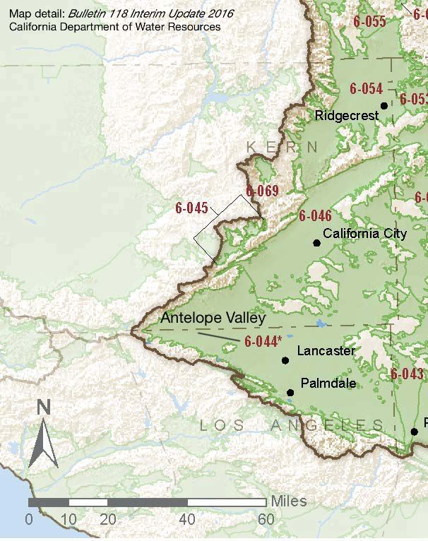
Antelope Valley
Statistics
- Basin Name
- Antelope Valley
- Basin Number
- 6-044
- SGMA Basin Priority
- Very Low
- Critically Overdrafted
- No
- Hydrologic Region Name
- South Lahontan
- Counties
- Kern, Los Angeles, San Bernardino
- Adjacent Basins
-
Fremont Valley 6-046, Upper Mojave River Valley 6-042,
At-A-Glance
Located in California’s South Lahontan hydrologic region, the Antelope Valley is 1,010,269 acres in size. This Very Low priority basin is home to an estimated 399,048 people (2010 value). It has approximately 3,305 wells, of which approximately 301 are public supply wells. Groundwater accounts for approximately 78.81 percent of the basin’s water supply.

Basin Notes
1999: 89.53% of the basin is adjudicated. Watermaster reports
2003: Bulletin 118 basin description
2014: CASGEM basin prioritization – high.
2018: Draft prioritization – very low. Comments:
- 1) CASGEM/WDL/GWIDS: No data or data insufficent to determine GWL status. Source: DWR 2) Overdraft and Subsidence, see lawsuit Pg 4 #10: In recent years, however, population growth and agricultural demands have led to increased pumping and declining groundwater levels… Source: Willis v Los Angeles County Waterworks No 40 et al
- 1) “Most groundwater pumping in the valley occurs in the Antelope Valley groundwater basin, which includes the rapidly growing cities of Lancaster and Palmdale. Groundwater-level declines of more than 270 feet in some parts of the groundwater basin have resulted in an increase in pumping lifts, reduced well efficiency, and land subsidence of more than 6 feet in some areas.” Source: USGS – Scientific Investigations Report 2014?5166 Groundwater-Flow and Land-Subsidence Model of Antelope Valley, California 2) Estimates of pumping in 2005 are in the 110-120K AF. 2012 was 90K AF. Court Adjudicated (pending?); Prior to 1972, groundwater provided more than 90 percent of the total water supply in the valley; since 1972, it has provided between 50 and 90 percent. ; Nearly four feet of land subsidence at Edwards Air Force Based between 1926 and 1992. From 1990 to 2000, nearly 0.4 feet of subsidence (Sneed and Galloway, 2000). Fissures range from one inch to over one foot wide and can be as long as 700 feet.. Ground deformation has affected the use of the lakebed as a runway for aircraft and space shuttles (Phillips, et al., 2003). Source: Aquifer-System Compaction and Land Subsidence: Measurements, Analyses, and Simulations – the Holly Site, Edwards Air Force Base, Antelope Valley, California, USGS
Noted: Los Angeles County Department of Public Works Antelope Valley Watershed links
Final Basin Prioritization: Un-adjudicated areas of basin status Very Low.
