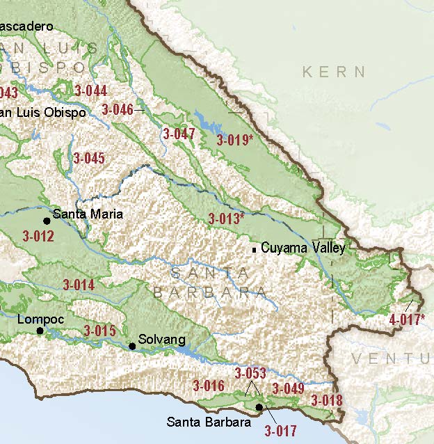
Cuyama Valley
Statistics
- Basin Name
- Cuyama Valley
- Basin Number
- 3-013
- SGMA Basin Priority
- High
- Critically Overdrafted
- Yes
- Hydrologic Region Name
- Central Coast
- Counties
- Kern, San Luis Obispo, Santa Barbara, Ventura
- Adjacent Basins
At-A-Glance
Located in California’s Central Coast hydrologic region, the Cuyama Valley is 241,730 acres in size. This High priority basin is home to an estimated 1,259 people (2010 value). Cuyama Valley is a basin with approximately 343 wells, of which approximately 8 are water supply wells. Groundwater accounts for approximately 100 percent of the basin’s water supply.

Basin Notes
2003: Bulletin 118 basin description
2014: Basin classed as being in critical overdraft. Basin prioritization notes: Groundwater levels-Longterm hydrographs show groundwater level decline. Source: DWR 2) In 1980, the Cuyama Valley Groundwater Basin was identified by the California Department of Water Resources as one of the eleven basins in critical condition of overdraft. Although the San Luis Obispo Integrated Regional Water Management Plan Appendix L. San Luis Obispo County Groundwater Basins Public Draft June 2014 29 San Luis Obispo County IRWM Region groundwater basin is experiencing serious hydrologic impacts due to unsustainable groundwater pumping practices, a groundwater management plan for the basin does not exist. Since this basin lies within four counties, future efforts for a county groundwater management plan will likely be difficult (Andersen et al., 2009). Source: L_Appendix_SLOGWBasins.pdf Subsidence comments: 1) USGS (2014-3075) projects additional permanent subsidence if current water demands continue. Source USGS; submitted via email to DWR, 10/21/2016 – Subsidence has been documented in the Cuyama Valley: http://pubs.usgs.gov/sir/2013/5108/ 2) USGS 2013-5108: Interpretations indicate that both elastic and inelastic compaction occurred in the basin. The cyclic variability in the daily land surface position in the lateral and vertical directions for CUHS indicated the aquifer sediments in the area had experienced elastic deformation. However, a longer-term downward trend likely represents inelastic deformation and indicates reduced storage capacity in the aquifer sediments. In 2011, motion in all the directions increased substantially and corresponded to compression of the aquifer sediments. The cyclic variation in the position of the land surface at CUHS also correlated with water-level measurements in nearby wells, which supports the conclusion that elastic deformation was caused by groundwater withdrawals. Source: USGS 2013-5108 3) Continuous GPS site in Cuyama Valley that shows recent subsidence (Scripps Orbit and Permanent Array Center) Sources: Scripps Orbit and Permanent Array Center, http://sopac.ucsd.edu/ 2015 County of San Luis Obispo Sustainable GW Proposal – Attachment 2
2016: Basin boundary modification request denied.
2018: Final Basin Prioritization: Basin status is changed from medium to high priority.
2019:
- December 2019: Groundwater Sustainability Plan (GSP) completed by Woodard & Curran
2020:
- January 21 – Cuyama Basin GSA filed GSP with Department of Water Resources (DWR)
2022: January 21 – GSP determined to be incomplete by DWR
- July 18 – New Groundwater Sustainability Plan (GSP) submitted to DWR
2023: May 25 – GSP approved by DWR
