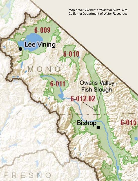
Owens Valley – Fish Slough
Statistics
- Basin Name
- Owens Valley – Fish Slough
- Basin Number
- 6-012.02
- SGMA Basin Priority
- Very Low
- Critically Overdrafted
- No
- Hydrologic Region Name
- South Lahontan
- Counties
- Mono
- Adjacent Basins
At-A-Glance
Located in California’s South Lahontan hydrologic region, the Owens Valley – Fish Slough is 3,222 acres in size. This Very Low priority basin is home to an estimated 27 people (2010 value). Groundwater is not part of the basin’s water supply.

Basin Notes
Fish Slough was included as an independent groundwater basin in Bulletin 118 (DWR, 1975) and Bulletin 118-80 (DWR, 1980), but dropped from Bulletin 118-2003 (DWR, 2003) on the reasoning that “Granite Mountain Area (6-59) and Fish Slough Valley (6-60) groundwater basins have been deleted because no information was found concerning wells or groundwater in these basins or because well completion reports indicate that groundwater production is derived from fractured rocks beneath the basin.” Shallow cores from Fish Slough show alluvium is a thin veneer on the order of ten feet atop Bishop Tuff. — Hydrogeologic Conceptual Model for the Owens Valley Groundwater Basin (6-12), Inyo and Mono Counties by Robert Harrington
Fish Slough – Area of Critical Environmental Concern – Bureau of Land Management (BLM)
2016: Basin boundary request by Owens Valley 6-012.01 denied
2018: Draft prioritization – Very Low.
Final Basin Prioritization: Very Low.
