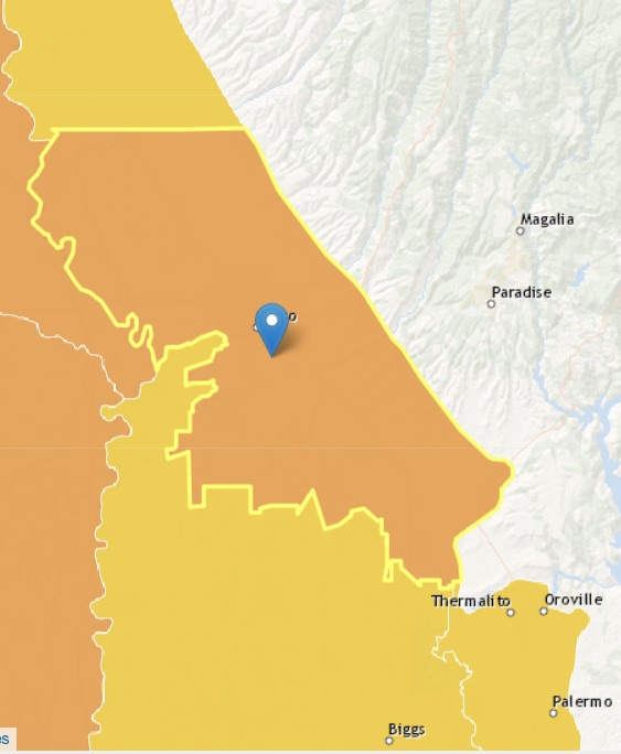
Sacramento Valley – Vina
Statistics
- Basin Name
- Sacramento Valley – Vina
- Basin Number
- 5-021.57
- SGMA Basin Priority
- High
- Critically Overdrafted
- No
- Hydrologic Region Name
- Sacramento River
- Counties
- Butte, Tehama
- Adjacent Basins
At-A-Glance
Located in California’s Sacramento River hydrologic region, the Sacramento Valley – Vina is 184,917.61 acres in size. This High priority basin is home to an estimated 108,258 people (2010 value). It has approximately 5859 wells, of which approximately 93 are water supply wells. Groundwater accounts for approximately 98 percent of the basin’s water supply.

Basin Notes
2003: Bulletin 118 basin description
2014: Basin prioritization – Comment: Groundwater from this basin is a key source of surface water inflow and serves eastside creeks, which have endangered spring run. Groundwater use based on B118-03 and 2005 Butte County Inventory.
2018: Draft priority – high. Comment: 1) CASGEM/WDL/GWIDS: Longterm hydrographs show groundwater level decline. Source: DWR Basin boundary request to consolidate basins with Tehama County pending Butte County basin boundary/consolidation request for Vina and the Wyandotte Creek 5-021.69, Corning 5-021.51, Colusa 5-021.52, West Butte 5-021.58, East Butte 5-021.59, Sutter 5-021.62 subbasins pending
2019: Basin boundary modification approved. Per DWR: It “consists of four parts. The first part revises and expands the Vina subbasin to cover groundwater dependent areas currently included in the northern portions of East Butte and West Butte subbasins. The modification extends the Butte County portion of Vina Subbasin southerly to the northern boundary of Western Canal Water District. The resulting Vina subbasin includes the City of Chico, unincorporated Durham, and the Durham Irrigation District. The second part modifies the western boundaries of the existing Butte County portion of Vina, and West Butte subbasins, near the Sacramento River to align with the Butte County line. The third part revises the southern boundary of the East Butte subbasin to follow the Butte/Sutter County line except for the Biggs-West Gridley Water District and Reclamation District 1004 jurisdictional boundaries; which results in these Districts being entirely within the resulting Butte subbasin. The fourth part consolidates the remaining East Butte and West Butte subbasin areas to form the Butte subbasin.” Phase 2 draft priority: high.
2022: January 28 – Groundwater Sustainability Plan (GSP) delivered to Department of Water Resources (DWR)
2023: July 27 – DWR approved GSP
