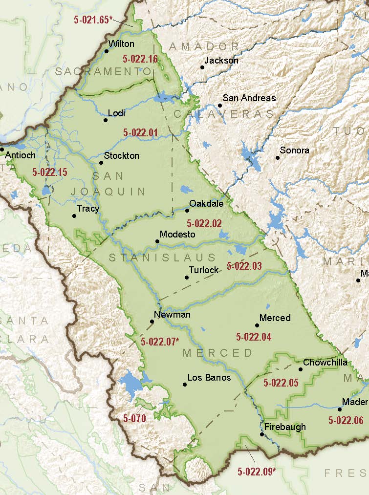
San Joaquin Valley – Merced
Statistics
- Basin Name
- San Joaquin Valley – Merced
- Basin Number
- 5-022.04
- SGMA Basin Priority
- High
- Critically Overdrafted
- Yes
- Hydrologic Region Name
- San Joaquin River
- Counties
- Merced
At-A-Glance
Located in California’s San Joaquin River hydrologic region, the San Joaquin Valley – Merced subbasin is 512,959 acres in size. This High priority basin is home to an estimated 174,527 people (2010 value). It has approximately 6126 wells, of which approximately 141 are water supply wells. Groundwater accounts for approximately 66.81 percent of the basin’s water supply.

Basin Notes
2003: Bulletin 118 basin description
2014: CASGEM basin prioritization – high
2018: Draft basin prioritization – high. Comments on groundwater level decline and subsidence:
- CRITICAL OVERDRAFT. Source: DWR 1) CASGEM/WDL/GWIDS: Longterm hydrographs show groundwater level decline. Source: DWR 2) The Merced Groundwater Basin is in a state of groundwater level decline with a cumulative decrease in storage of approximately 720,000 ac-ft from 1980 to 2007.
- Sources : 1) Current Land Subsidence in the San Joaquin Valley, USGS; 2) 2014 – Land Subsidence from Groundwater Use in California, California Water Foundation / James W. Borchers / Michael Carpenter, Luhdorff & Salmanini, April 2014; 3) Progress Report: Subsidence in the Central Valley, California, Jet Propulsion Laboratory, California Institute of Technology, NASA 2015-16; 4) San Joaquin River Restoration Program / US Bureau of Reclamation monitoring
2018: Final Basin Prioritization: Basin status remains unchanged at high priority.
2019: November 12 – GSP published under joint powers agreement by the Merced Irrigation-Urban Groundwater Sustainability Agency (MIUGSA), the Merced Subbasin Groundwater Sustainability Agency (MSGSA), and the Turner Island Water District Groundwater Sustainability Agency (TIWD GSA)
2020: January 28 – GSP submitted to DWR
2021: DWR writes Merced GSP Plan Manager warning the GSP is deficient and to expect a determination of incomplete
2022: January 28 – DWR writes outlining deficiencies, including “The GSP does not provide sufficient justification for identifying that undesirable results for chronic lowering of groundwater levels, subsidence, and depletion of interconnected surface waters can only occur in consecutive non-dry water year types,” “The GSP has not defined sustainable management criteria for chronic lowering of groundwater levels in the manner required by SGMA and the GSP Regulations,” and “The GSP has not defined sustainable management criteria for land subsidence in the manner required by SGMA and the GSP Regulations.” The GSA is given until July 27 to re-submit a revised version.
July 26 – GSA submits a revised GSP
2023: August 4 — GSP approved by DWR
2024: July 31 – US Fish and Wildlife Service releases the 15-year plan, the San Luis National Wildlife Refuge Complex Final Comprehensive Conservation Plan and Environmental Assessment
