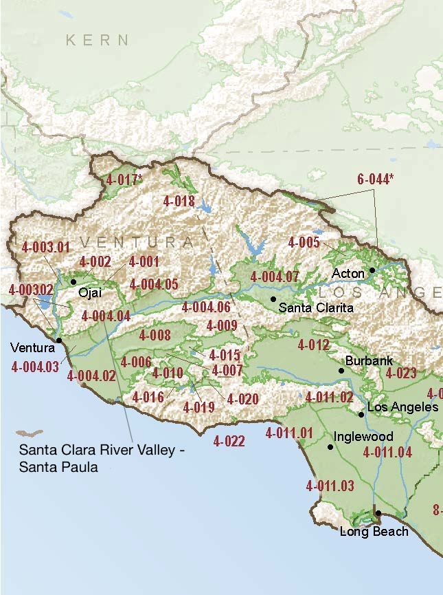
Santa Clara River Valley – Santa Paula
Statistics
- Basin Name
- Santa Clara River Valley – Santa Paula
- Basin Number
- 4-004.04
- SGMA Basin Priority
- Very Low
- Critically Overdrafted
- No
- Hydrologic Region Name
- South Coast
- Counties
- Ventura
At-A-Glance
Located in California’s South Coast hydrologic region, the Santa Clara River Valley – Santa Paula subbasin is 22,112 acres in size. This Very Low priority basin is home to an estimated 47,755 people (2010 value). It has approximately 242 wells, of which approximately 9 are water supply wells. Groundwater accounts for approximately 90 percent of the basin’s water supply.

Basin Notes
87% adjudicated basin with outlying area GSA
1996: Original judgment
2003: Bulletin 118 basin description
2010: Amended judgment
2014: CASGEM Basin Prioritization: medium. Water quality ote: Nitrates can fluctuate significantly in the basin, and above MCL. Other inorganics present above MCL. TDS is known to be high.
2018: Draft basin prioritization comments – Groundwater levels: Longterm hydrographs show groundwater level decline. Source: DWR 2) The the majority of wells in the Santa Paula basin have experienced a gradual GWL decline during the 1998-2005 observation period and the 2005 to present observation period. The water level fluctuations observed from 1998 to 2009 in the Santa Paula Basin cannot be attributed soley to spatial or temporal variations in pumping. Source: 2016 Annual Investigation and Report of Groundwater Conditions Within United Water Conservation District Salt intrusion: 1) Although groundwater levels in the Oxnard Plain area (Mound, Oxnard, Santa Paula, Pleasant Valley, & Las Posas Valley) have been relatively stable or have shown an increasing trend, in the coastal regions this stability is largely due to seawater intrusion and results in water of unusable quality replacing high quality groundwater. Rising groundwater levels in the Las Posas Valley are a result of active management to increase groundwater recharge beneath the Arroyo Las Posas. Seawater intrusion began in the Oxnard Plain area by 1930s and was widespread as early as the 1940s. Changes in groundwater management, including pumping reductions, shifting of pumping locations, construction of the Freeman Diversion, and the operation of the Pumping Trough and Pleasant Valley pipeline systems have significantly reduced seawater intrusion, but seawater intrusion conditions persist. Source: CentralCoastGWReport-Aug2014.pdf 2) Water purveyors in the Piru, Fillmore, Santa Paula, Mound, and Oxnard subbasins include United Water Conservation District and Ventura County. United Water Conservation District operates surface water facilities to encourage groundwater protection through conjunctive use (UWCD 2012). Groundwater issues within the United Water Conservation District service area (which includes all of the basin) include overdraft conditions, sea water intrusion, and high nitrate concentrations. Source: Long Term Operation EIS, Chapter 7, U.S. Bureau of Reclamation (USBR) 2019: Basin boundary modification approved. It revised and aligned the shared boundary between the Mound and Santa Paula subbasins to align with the Santa Paula adjudicated boundary. The modification also revised the shared boundary between the Oxnard, Mound, and Santa Paula subbasins to align with the Fox Canyon Groundwater Management Agency’s boundary and the Santa Paula adjudication boundary. Draft priority: Very low.
